Forest Surveyors collect precise field data on tree species, terrain, and growth conditions to assess forest health and timber resources. GIS Specialists analyze spatial data using advanced mapping software to model forest ecosystems and support resource management decisions. Both roles are essential in sustainable forestry, combining ground-level observations with digital spatial analysis for comprehensive forest management.
Table of Comparison
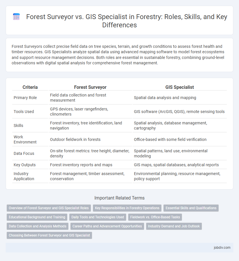
| Criteria | Forest Surveyor | GIS Specialist |
|---|---|---|
| Primary Role | Field data collection and forest measurement | Spatial data analysis and mapping |
| Tools Used | GPS devices, laser rangefinders, clinometers | GIS software (ArcGIS, QGIS), remote sensing tools |
| Skills | Forest inventory, tree identification, land navigation | Spatial analysis, database management, cartography |
| Work Environment | Outdoor fieldwork in forests | Office-based with some field verification |
| Data Focus | On-site forest metrics: tree height, diameter, density | Spatial patterns, land use, environmental modeling |
| Key Outputs | Forest inventory reports and maps | GIS maps, spatial databases, analytical reports |
| Industry Application | Forest management, timber assessment, conservation | Environmental planning, resource management, policy support |
Overview of Forest Surveyor and GIS Specialist Roles
Forest surveyors specialize in collecting and analyzing data on forest composition, tree dimensions, and site conditions through ground-based measurements and remote sensing techniques, essential for sustainable forest management. GIS specialists utilize geographic information systems to map, visualize, and analyze spatial forest data, enabling precise monitoring of forest health, land use changes, and resource planning. Together, these roles complement each other by integrating field data collection with advanced geospatial analysis to support effective forestry decision-making.
Key Responsibilities in Forestry Operations
Forest surveyors specialize in measuring forest attributes such as tree height, age, density, and health, relying on field data collection techniques to assess timber volume and growth patterns. GIS specialists manage spatial data by creating and analyzing detailed maps, enabling precision in forest planning, resource management, and monitoring environmental changes. Both roles contribute critical data for sustainable forestry practices, with surveyors focusing on ground-level measurements and GIS specialists integrating geospatial information for comprehensive forest management.
Essential Skills and Qualifications
Forest Surveyors excel in land measurement, topographic mapping, and tree species identification, requiring proficiency in GPS technology, compass use, and forest mensuration techniques. GIS Specialists focus on spatial data analysis, digital mapping, and database management, utilizing software like ArcGIS and QGIS alongside strong programming skills in Python or SQL. Both roles demand a solid understanding of forestry principles, but Forest Surveyors emphasize fieldwork precision while GIS Specialists prioritize data interpretation and geospatial visualization.
Educational Background and Training
Forest surveyors typically have a background in forestry, environmental science, or natural resource management, often holding degrees in these fields. GIS specialists usually possess education in geographic information systems, computer science, or geography, emphasizing spatial data analysis and mapping technologies. Training for forest surveyors includes fieldwork skills and ecological assessment, while GIS specialists focus on software proficiency such as ArcGIS and remote sensing techniques.
Daily Tools and Technologies Used
Forest surveyors primarily use tools such as GPS devices, total stations, and clinometers to measure and map forest terrain accurately, while GIS specialists rely heavily on software like ArcGIS, QGIS, and remote sensing data to analyze spatial information and generate detailed forest maps. Both roles utilize drones and LiDAR technology for data collection, but forest surveyors focus on ground-based measurements whereas GIS specialists emphasize data processing and visualization. The integration of these technologies enhances forest management, enabling precise monitoring of tree inventories, health assessments, and land use planning.
Fieldwork vs. Office-Based Tasks
Forest surveyors predominantly engage in extensive fieldwork, collecting data on tree species, growth patterns, and environmental conditions using GPS devices and traditional surveying tools. GIS specialists concentrate on analyzing and interpreting spatial data within office settings, utilizing software like ArcGIS to create detailed maps and models for forest management planning. The collaboration between field data collection and advanced spatial analysis ensures accurate and effective forestry resource assessment and decision-making.
Data Collection and Analysis Methods
Forest Surveyors primarily utilize ground-based techniques such as total stations, GPS devices, and manual sampling for accurate tree measurements and forest inventory data collection. GIS Specialists leverage remote sensing technologies, satellite imagery, and spatial analysis software to process and analyze geospatial data for forest management and planning. Combining these methods enhances forest data accuracy, enabling precise monitoring of forest health, growth patterns, and resource distribution.
Career Paths and Advancement Opportunities
Forest surveyors and GIS specialists in forestry offer distinct career paths with unique advancement opportunities. Forest surveyors focus on field data collection, timber measurement, and land assessment, advancing toward roles like senior surveyor or forestry manager. GIS specialists leverage spatial data analysis and mapping technologies, progressing to positions such as GIS analyst lead or forest GIS coordinator, often expanding into environmental planning and resource management.
Industry Demand and Job Outlook
The demand for Forest Surveyors remains strong due to the critical need for precise field data collection and forest management, especially in timber and conservation sectors. GIS Specialists are experiencing rapidly growing job prospects as the forestry industry increasingly relies on spatial data analysis, remote sensing, and geospatial technologies to support sustainable resource planning. Both roles are vital, but GIS Specialists benefit from broader application across environmental monitoring, urban planning, and natural resource management, driving higher long-term employment growth.
Choosing Between Forest Surveyor and GIS Specialist
Choosing between a Forest Surveyor and a GIS Specialist depends on project goals; a Forest Surveyor excels in on-ground data collection, timber volume measurement, and boundary mapping, providing accurate field-based forest assessments. A GIS Specialist specializes in spatial data analysis, remote sensing, and digital mapping technologies, enabling advanced forest resource modeling and landscape-level planning. For comprehensive forest management, integrating both expertise ensures precise data acquisition and sophisticated spatial analysis.
Forest Surveyor vs GIS Specialist Infographic